ISRO Begins Lidar Survey of Rajgir’s Archaeological Sites, Including Ajatashatru Fort and Cyclopean Wall
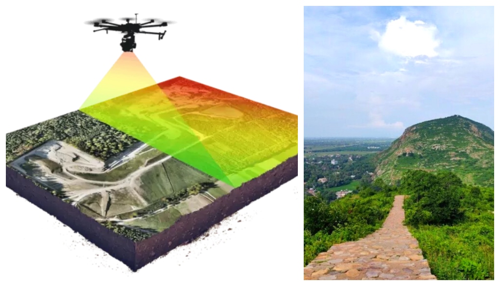
Rajgir/Patna: Scientists from the Indian Space Research Organisation (ISRO) have begun a Lidar (Light Detection and Ranging) survey in Rajgir to scientifically validate historical facts about the region, including the ancient expanse of Nalanda University and the Ajatashatru Fort. The project, initiated on Thursday, marks a major step in integrating space technology with archaeology to reconstruct the cultural heritage of one of India’s oldest cities.
A six-member ISRO team from Dehradun has taken up the task of mapping Rajgir’s historical terrain using advanced Lidar technology, which enables high-resolution 3D imaging of surface structures and subsurface features. The survey aims to corroborate findings from previous excavations by the Archaeological Survey of India (ASI) and to cross-reference them with global historical records on Rajgir and Nalanda.
The Ajatashatru Fort Ground is the focal point of the current phase. It was last excavated over a century ago, and renewed exploration has stirred public interest. Alongside, the scientists are examining the ancient Cyclopean Wall—older than the Great Wall of China and renowned for its unique stone masonry. The wall, a defensive structure believed to date back to the Magadhan empire, has long intrigued historians for its construction techniques.
The initiative is part of a wider ASI masterplan led by Dr Sujit Nayan, Superintendent Archaeologist of the Patna Division. His excavation team had unearthed several significant artefacts at the fort ground, and now ISRO scientists will use Lidar scans to validate and enhance those findings.
On the first day, the team delineated the fort’s boundaries and began remote sensing of underground features. District officials momentarily halted the survey due to concerns over aerial drone use, but resumed the operation after confirming its scientific nature.
Lidar technology, which employs laser beams to measure distances and build detailed topographic models, is increasingly used in archaeological surveys worldwide. It can reveal hidden architectural patterns, detect ancient infrastructure, and map structures buried under vegetation or soil, offering new insights without damaging the site.
The collaboration between ASI and ISRO is expected to offer an unprecedented view into Rajgir’s past, including its urban layout, defensive mechanisms, and religious significance during the time of Gautam Buddha and beyond.