
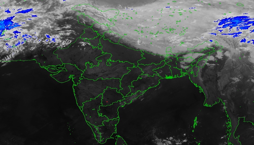
Patna: Latest satellite images captured around midnight show low clouds moving toward parts of north Bihar, particularly the districts of Araria, Kishanganj and Purnea, raising the likelihood of rainfall that could bring temporary relief from the recent surge in temperatures.

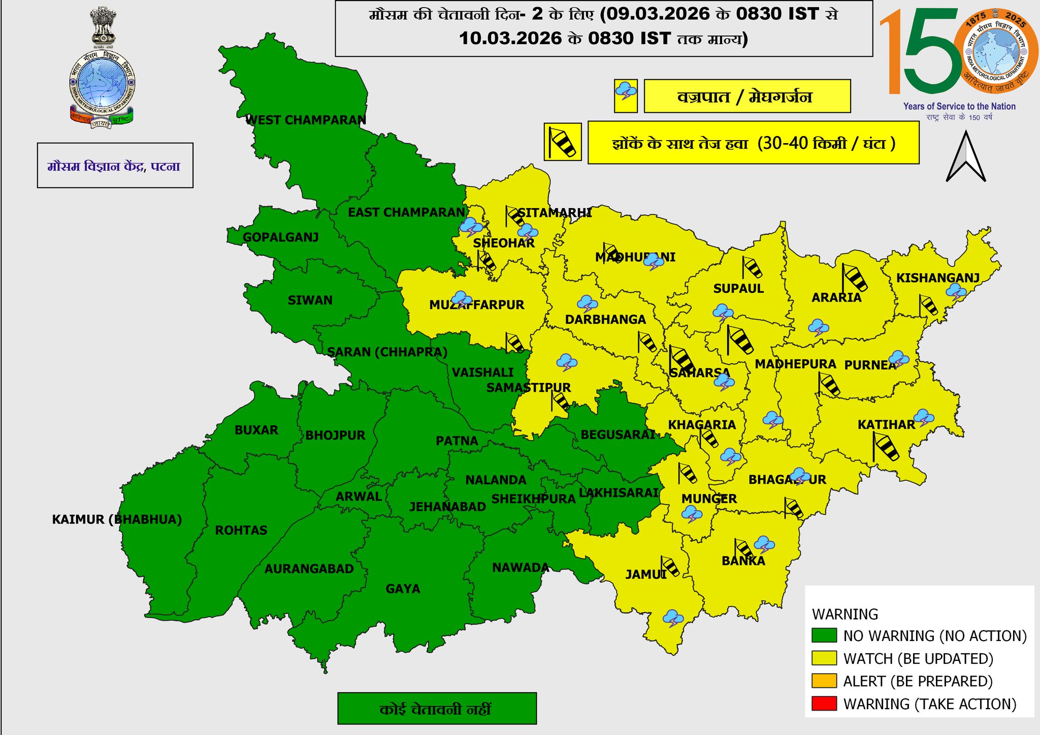
According to the Patna meteorological centre, the cloud movement may lead to thunderstorms, lightning and strong winds in several parts of the state between March 9 and the morning of March 10.
Officials have advised residents in northern and eastern districts to remain cautious as wind speeds of 30 to 40km/h are expected along with thunderstorm activity.

Districts likely to experience the changing weather include Sitamarhi, Sheohar, East Champaran, Madhubani, Darbhanga, Muzaffarpur, Samastipur, Supaul, Saharsa, Madhepura, Purnia, Araria, Kishanganj, Katihar, Khagaria, Bhagalpur, Munger, Jamui and Banka.
Temperature readings across the state indicate warm conditions continuing before the expected weather change.
The lowest minimum temperature in Bihar on Sunday was recorded at 17.5C in Agwanpur in Saharsa district. In Patna, the maximum temperature reached 34C while the minimum was recorded at 22C.
The meteorological centre has also issued a short-term forecast for Patna. Partly cloudy skies are expected on March 9 with temperatures likely to range between 23C and 33C.
Similar conditions are expected on March 10 with little change in temperature. Cloud cover may increase further on March 11, while partly cloudy skies are expected again on March 12.


