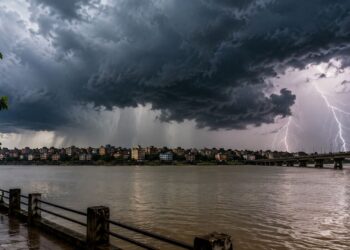
Patna: The southwest monsoon remains active over Bihar, with several districts receiving rain over the past few days. The India Meteorological Department (IMD) has issued a yellow alert for heavy rain and strong winds in 19 districts for August 13 and 14, while flood concerns are growing in parts of north Bihar following rising river levels and continued rainfall in Nepal’s Terai region.

The weather department has forecast rain in different parts of Bihar until August 12, with heavy rainfall possible in some districts of north Bihar. Strong winds of around 40 kmph are also likely in some areas. Weather conditions are expected to improve after August 15.
According to the weather department, Bihar received 369.6 mm of rainfall up to August 9, against the normal cumulative rainfall of 573.4 mm for the period. This represents a 36% rainfall deficit across the state so far this monsoon.

Flood threat increases in several districts
The impact of rising river levels is already being reported from several parts of the state.
In Gopalganj, continuous rainfall in Nepal’s Terai region has increased the flood threat. Water has entered several villages in the diara areas, affecting homes, agricultural fields and roads.
In Bagaha, water from the Gandak River has entered around 300 houses across two panchayats, forcing residents to use boats for movement.
The Bagmati River is also in spate in Muzaffarpur following rainfall in Nepal. More than 12 houses in Bakuchi village have reportedly been inundated.
In Begusarai, severe erosion has started along the Ganga near Mahendrapur village in the Matihani block area, raising concerns among residents living close to the riverbank.
The rising water level of the Ganga in Khagaria has also begun affecting low-lying areas. A small bridge connecting Parbatta block with Nayagaon Diara has been completely submerged, disrupting access to the diara region.
A section of the embankment of the Tirhut Main Canal has also reportedly breached, adding to concerns over waterlogging and flooding in affected areas.
Heavy rain recorded in several districts
Kishanganj recorded the highest rainfall in the state during the past 24 hours. Galgalia in Kishanganj received 128.6 mm of rain, according to weather department data.
Other significant rainfall figures included:
- Madanpur, Aurangabad: 70.4 mm
- Jale, Darbhanga: 44.2 mm
- Birpur, Supaul: 32 mm
- Khutauna, Madhubani: 31.2 mm
- Belaganj, Gaya: 27.4 mm
- Bihar Sharif, Nalanda: 25 mm
- Khaira-Katoria, Jamui: 24.8 mm
- Katoria, Banka: 23.6 mm
Heavy rain also caused waterlogging in Haveli Kharagpur in Munger on Sunday evening, affecting several areas.
In Patna, heavy rain lashed the city on Saturday night, including areas around JP Ganga Path. Bettiah also experienced heavy rain, with cloudy conditions prevailing throughout the day. In Nalanda, a sudden spell of rain brought some relief from the humid heat.
Rain deficit remains significant
Despite recent spells of rain, several districts continue to face a substantial rainfall deficit.
According to the weather department’s data, Kaimur has recorded a rainfall deficit of around 99%, while East Champaran, Sitamarhi and Khagaria have also recorded deficits of up to 100%.
The figures indicate that Bihar’s overall monsoon rainfall remains significantly below normal despite the recent increase in rainfall activity.
Heavy rain and thunderstorms likely on August 13-14
The weather department has forecast heavy rainfall across parts of Bihar on August 13 and 14, with thunderstorms and strong winds possible in several districts.
A yellow alert has been issued for 19 districts: Jehanabad, Saran, Siwan, Buxar, Gaya, Patna, Begusarai, Samastipur, Darbhanga, Madhubani, Purnia, Kishanganj, Araria, Saharsa, Supaul, Khagaria, Bhagalpur, Lakhisarai and adjoining affected areas as covered by the warning.
The weather department has advised residents in vulnerable areas to remain alert as heavy rain could lead to further rises in river levels, waterlogging and localised flooding.
Overall, Bihar is likely to experience variable weather conditions over the next several days, with rainfall activity continuing through August 12, another spell of heavy rain expected on August 13-14, and comparatively clearer conditions likely after August 15.