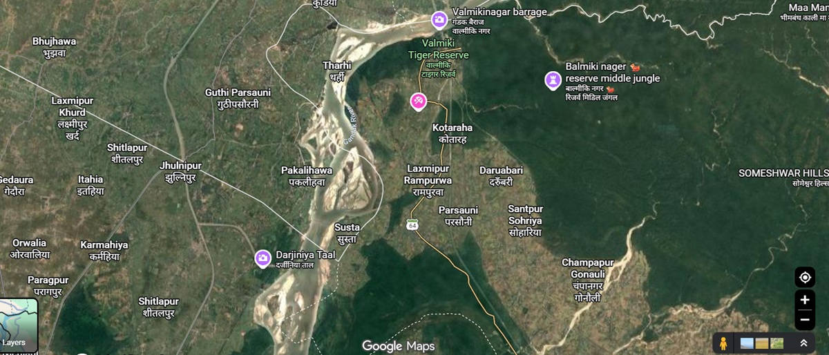
Bettiah: The risk of erosion by the Gandak River has increased in Indian territory near Susta village along the India-Nepal border following embankment construction on the Nepal side, according to a letter from Sashastra Seema Bal (SSB) Director General Sanjay Singhal to Bihar’s Chief Secretary and the Divisional Commissioner.

The SSB chief has sought the formation of an expert committee and immediate measures to prevent further erosion in the area. He has also requested the construction of three key all-weather roads to strengthen connectivity and operational presence in the sensitive border region.
Divisional Commissioner Girivar Dayal Singh has directed the West Champaran District Magistrate to take necessary action. An emergency video conference on the issue has also been scheduled for September 8.

Embankment work raises concerns over river flow
According to the letter, on August 2, some residents of Susta village in Nepal, allegedly with the support of anti-social elements, attempted to extend an embankment by violating the agreed status quo line.
The letter states that it had been agreed that the status quo line would not be violated and that no embankment construction would be carried out near the line. However, an extension of the embankment was subsequently carried out towards the Indian side.
The situation was restored after the SSB received information about the development.
The SSB expressed concern that the extension and strengthening of the embankment on the Nepal side could alter the flow of the Gandak River towards Indian territory, increasing the risk of erosion.
River changes course, status quo marker washed away
The SSB informed authorities on August 12 that the Gandak’s strong flow had changed its course towards the Indian side. As a result, severe erosion was reportedly taking place along the eastern bank near Dhanaiyareta and further east in Indian territory.
The erosion has also affected an important reference point marking the status quo line. A pakkad tree, which served as a key reference point, was uprooted and washed away by the river. The erosion is now progressing towards a semal tree, another reference point in the area.
According to the SSB, one current channel of the river is flowing towards Rahua Nala after passing around 200 metres inside Indian territory, beyond the location of the pakkad tree and towards the semal tree.
There is concern that this channel could eventually become the river’s main course. Such a change could inundate the status quo line maintained by the SSB since 2005, as well as adjoining Indian territory near Susta.
SSB seeks expert committee, roads
In view of the ongoing erosion, the SSB Director General has sought immediate intervention from the state authorities. The requests include:
- Formation of an expert committee to assess the erosion and take measures to protect Indian territory.
- Construction of all-weather roads connecting Border Outposts Chakdawa, Rampurwa and Jhentutola with the status quo line.
- Construction of an all-weather road from Border Outpost Chakdawa to Harihar Bridge.
- Construction of a road from Harihar Bridge to Border Outpost Jhentutola/Jhentutola village.
The SSB has stressed the need for urgent measures to control erosion and maintain an effective operational presence in the Susta area.