

Patna: The southwest monsoon has lost momentum across India, including Bihar, leading to a sharp rise in temperatures and uncomfortable humidity across several districts in the state.

On Tuesday, temperatures crossed the 40-degree Celsius mark in seven districts, with Kaimur emerging as the hottest location at 42.2°C. Buxar recorded 41.4°C, while Dehri registered 40.4°C. The temperature in Patna touched 40°C.
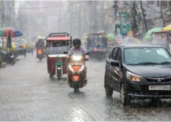
According to the India Meteorological Department (IMD), rainfall is likely in 26 districts of Bihar on Wednesday. The weather agency has forecast rain accompanied by strong winds over the next four to five days in several parts of the state, with wind speeds expected to reach up to 50 kmph.

The IMD said weather conditions are expected to change across all districts after June 22, bringing more widespread monsoon activity.
Weather Conditions Over the Past 24 Hours
Residents across Patna and several other districts experienced intense sunshine and high humidity over the past 24 hours. Temperatures remained significantly above normal in many areas.
Apart from Kaimur, Sheikhpura recorded 40.9°C, while Aurangabad registered 40.8°C.
Rainfall Forecast
June 17: Thunderstorms accompanied by strong winds are likely in north and south-west Bihar. Heavy rainfall is expected in Bhagalpur, Katihar, Kishanganj and Purnia.
June 18: Thunderstorm and rain activity is expected to intensify across north-central, north-eastern and south-eastern Bihar. Heavy rainfall alerts have been issued for Araria, Madhubani, Kishanganj and Supaul.
June 19: Wind speeds of 50-60 kmph are likely in north Bihar. Heavy rainfall is expected in East Champaran, West Champaran and Sitamarhi districts.
Monsoon Clouds Missing from Satellite Images
Satellite imagery captured on June 15 showed a significant reduction in monsoon cloud cover across large parts of the country, indicating a temporary slowdown in the advancement of the southwest monsoon.
According to the IMD, India received only 19.2 mm of rainfall between June 4 and June 15, compared to the normal average of 53.7 mm during the same period, marking a rainfall deficit of 64%.
The weak monsoon activity has delayed rainfall in 16 states, including Bihar, Rajasthan, Maharashtra, Madhya Pradesh, Chhattisgarh, Uttar Pradesh and Delhi.
After advancing through southern India, the monsoon has stalled around Maharashtra, Telangana and Andhra Pradesh. Following its progression into the northeastern states, its advance has also slowed over Bihar, Jharkhand and West Bengal.
Why Has the Monsoon Stalled?
The IMD said the slowdown is not due to a lack of moisture over the seas but because of unusual upper-atmospheric wind patterns.
Meteorologists said the western jet stream has shifted farther south than usual this year, disrupting the winds that typically drive the monsoon system inland.
Despite adequate moisture availability over the Arabian Sea and the Bay of Bengal, cloud formation has remained limited, temporarily halting the monsoon’s progress. However, weather experts expect the monsoon to regain strength over the coming days, while pre-monsoon rainfall continues in parts of Madhya Pradesh, Rajasthan and other states.


 criticised Bihar Chief Minister Samrat Choudhary, alleging that the government")


