
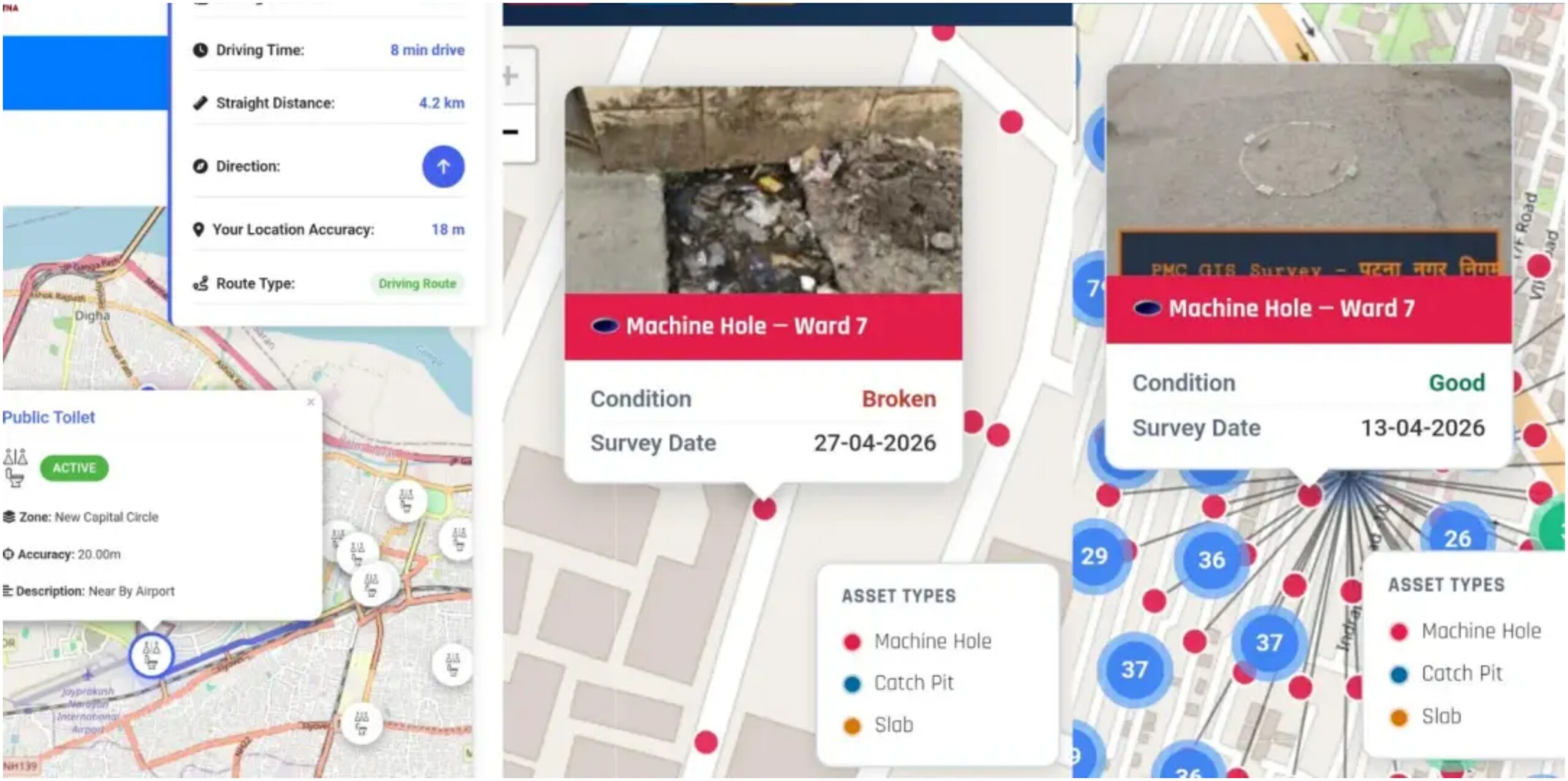
Patna: The Patna Municipal Corporation (PMC) has digitised its public assets to improve transparency and make civic services more accessible to residents. Through GIS tagging, the Corporation has mapped public infrastructure across all 75 wards and made the information available on its official website. A citizen-centric mobile application is also under development and will be launched soon.

The initiative enables residents to view ward-wise civic information, locate public facilities and access details of municipal infrastructure directly from their mobile phones. According to the Corporation, the platform aims to simplify access to public services while improving administrative efficiency.
‘Get My Ward’ Connects Residents With Officials

The new ‘Get My Ward’ feature allows users to identify their ward based on their location. Once selected, the portal displays the ward name along with the names and contact numbers of officials, including the Executive Officer, City Manager, CSI, SI, Executive Engineer and Assistant Engineer.
The portal also provides a digital map showing the administrative boundaries of each ward, helping residents identify the officials responsible for civic services in their locality.
Digital Mapping Of Drainage Infrastructure
PMC has also created a digital map of the city’s drainage network to strengthen monitoring during the monsoon. Users can select any of the city’s 75 wards to view technical details of manholes, catch pits and slabs.
The platform includes information such as location, depth, size, cover condition and silt levels, along with photographs and videos. According to the Corporation, the system will help officials monitor waterlogging and drainage blockages more effectively during emergencies.
Online Access To Civic Amenities
The ‘PMC Assets’ section displays 18 categories of public facilities on a single digital map. These include public toilets, parks, parking areas, CCTV cameras, cremation grounds, sump houses, water pump houses, German hangars and municipal vehicle yards.
Residents can check the location, operational status, distance from their current position and route map for each facility through the online platform.
Advertising Assets Mapped To Improve Monitoring
PMC has also completed a digital assessment of hoardings and advertising sites within its jurisdiction. Users can search by zone, ward, ownership and agency to view authorised advertising locations.
According to the Corporation, around 11.51 lakh square feet of advertising space has been identified. Officials said the mapping exercise is expected to help curb illegal hoardings and improve municipal revenue collection.
Commissioner Highlights Benefits
Municipal Commissioner Yashpal Meena said digitising civic assets would enhance transparency and make information about nearby public facilities easier to access. He added that the system would also enable live monitoring of hoardings, manholes, drains and other civic infrastructure from the Corporation headquarters.