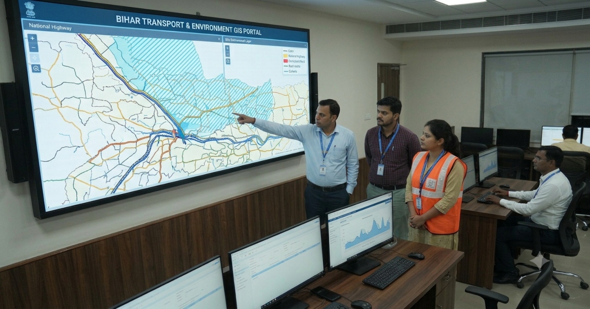
Patna : The Bihar government is preparing a Geographic Information System (GIS)-based digital map of the state’s transport network, covering railway lines, national and state highways, district roads, rural routes, bridges and culverts.

The initiative aims to bring transport-related information onto an integrated digital platform, allowing officials to assess connectivity, identify infrastructure gaps and plan future development projects more effectively.
The responsibility for implementing the initiative has been assigned to the Science, Technology and Technical Education Department.

The proposed digital record will also include information on environmental risks around transport infrastructure, helping authorities assess local geographical conditions before finalising construction and expansion projects.
Roads, Railways And Bridges To Be Mapped
The digital map will cover different categories of transport infrastructure across Bihar, from major highways and railway tracks to district roads, rural routes and bridges.
Data already available on Bihar’s existing GIS portal, including information on expressways, national highways, state highways, major district roads and railway tracks, will also be made more useful under the initiative.
By integrating these details, the platform is expected to provide a clearer picture of the location of transport links and how different parts of the network connect.
The information could help officials identify areas where road connectivity needs improvement, railway links require expansion or additional bridges may be necessary.
Flood-Prone Areas And Environmental Risks To Be Recorded
Alongside transport infrastructure, the proposed GIS record will document environmental challenges that could affect construction and maintenance work.
These may include flood-prone areas, waterlogging, rivers, drains, erosion-prone locations, forest areas and potential pollution risks.
Recording these factors on a digital map could help officials understand the geographical conditions surrounding proposed roads, railway lines and bridges.
The information is expected to support planning decisions by highlighting possible environmental constraints and helping authorities identify precautions before construction begins.
The government also plans to update the digital record periodically to reflect new roads, highway expansions, repairs and other changes to the transport network. Environmental changes over time could also be documented.
Before-And-After Photographs To Monitor Construction
The initiative will also introduce a photographic record of transport projects to help officials monitor changes at construction sites.
Photographs will be taken before construction begins and after the work is completed, with the images recorded in the GIS database.
Comparing these photographs will allow officials to assess changes at project sites and review construction progress.
The system could also help identify problems that become apparent during site inspections and flag potential irregularities for further examination.
Maintaining a photographic record alongside geographical information is expected to make project monitoring more systematic.
Digital Data To Help Set Project Priorities
The GIS platform is also intended to support decisions on where transport infrastructure should be expanded or improved.
By examining the available data, officials could identify areas that need better road access, improved railway connectivity or additional bridges.
The information could help the government prioritise infrastructure projects according to local requirements and assess connectivity gaps across different regions.
An integrated digital database is also expected to improve coordination between departments involved in transport planning, construction and maintenance.
Minister Sheela Mandal Highlights Better Coordination
Science, Technology and Technical Education Minister Sheela Mandal said the GIS-based system would help determine project priorities, improve coordination among departments and strengthen the monitoring of development work.
She also said the digital record would help authorities assess requirements for road connectivity, railway links and bridges using available data.
The initiative is intended to provide officials with a common source of geographical and infrastructure information for planning and reviewing transport projects.
Digital Mapping To Support Long-Term Transport Planning
Bihar’s proposed GIS-based transport record is designed to combine infrastructure details, environmental information and construction monitoring data on one platform.
If implemented and regularly updated, the system could help authorities identify connectivity gaps, account for environmental risks and review the progress of infrastructure projects more effectively.
The immediate objective is to create a comprehensive digital record that supports better transport planning, interdepartmental coordination and evidence-based decisions across Bihar.