
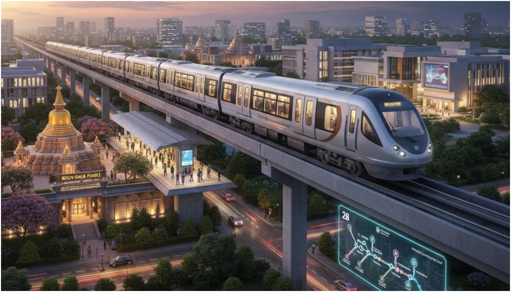
Gaya: The city of Gaya is set to witness rapid metro development in 2026, with plans for two corridors covering a combined 36 kilometres. The first phase of surveys has been completed, and routes have been largely finalised, city officials say.

The North-South corridor, stretching 22.7km, will start at IIM Bodh Gaya and reach Domuhan as its first station. From there, it will pass Tekuna Farm Mod, Gaya Airport, and Paharpur OTA before continuing into the city via Sikariya Mod, Gaya College, and Gandhi Maidan Jayprakash Jharna, eventually terminating at Sun City Chalakand. A total of 18 stations are planned on this corridor, including an interchange station at Paharpur.
The East-West corridor, measuring 13.48km, will run from the Paharpur interchange to Lakhanpur via Brahmavan, Kodihara, Nauli, Ashok Bihar Colony, Sur Hari, Siddharthpuri Colony, and Rasalpur, with 10 stations in total. Service stations are proposed at IIM Bodh Gaya for Corridor 1 and at Lakhanpur for Corridor 2.

Both corridors will connect major religious landmarks, including the Mahabodhi Temple and Vishnupad Temple, providing pilgrims with easier access. From Domuhan, the Mahabodhi Temple is only 1.5km away, while the Vishnupad corridor, accessible via the bypass near Paharpur, may include a pedestrian path for devotees performing Pind Daan during the Pitru Paksha fair and other occasions.
The station layout was finalised following joint surveys by RITES and the district administration, with input from local representatives and citizens. “After completing the survey last year, RITES submitted the feasibility, mobility, and alternative analysis reports to the Urban Development Department. We will review these further,” said Shashank Shubankar, District Magistrate.
While the survey has been completed, final government approval for the metro routes is still pending. Once operational, the Gaya Metro is expected to transform urban mobility and improve access to both educational and religious centres across the city.


