
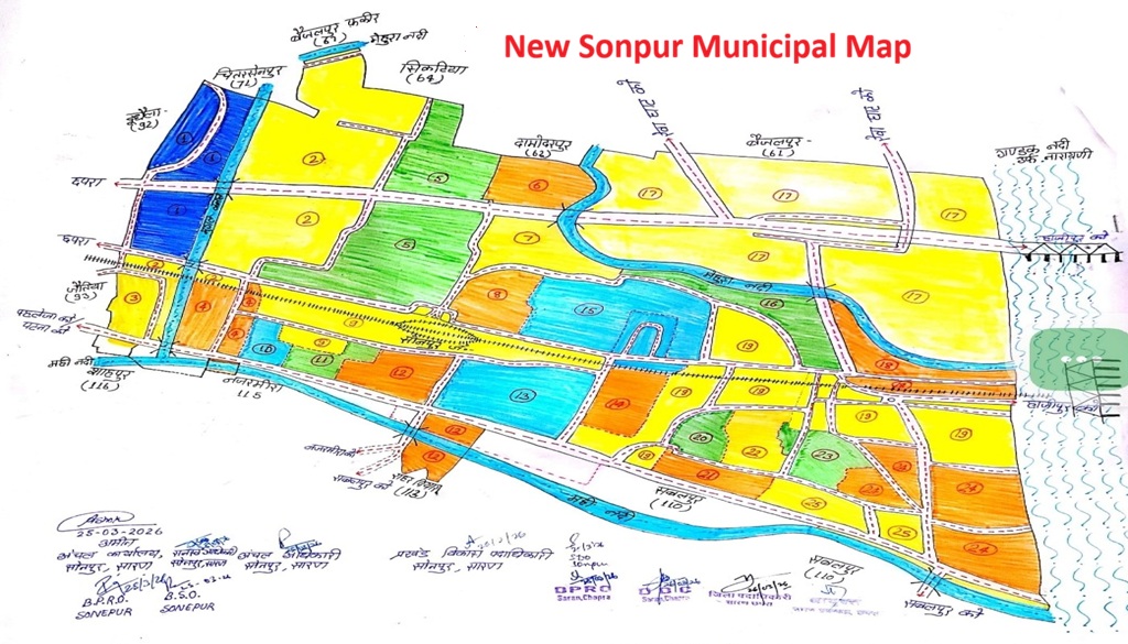
Sonpur: A new urban map of Sonpur has been officially prepared to support the expansion of the Sonpur Municipal Council and streamline future urban planning in the region. The document lays out a structured vision for development, clearly marking wards, water bodies and key transport routes.

Geographically, the town is bordered by the Gandak River on one side and the Mahi River on the other, both of which play a crucial role in natural drainage and contribute to the area’s landscape. The map also highlights the flow zone of the Mehura River, underlining its importance in flood and water management planning.
The layout divides the town into 25 distinct zones or wards, each marked with numbers and colour codes. Yellow and green indicate residential and agricultural areas, blue marks rivers and water bodies, while orange denotes densely populated or specially designated zones.

Key connectivity routes linking Sonpur to nearby urban centres such as Chhapra, Hajipur and Patna are clearly outlined. The railway line running through the town is also prominently featured, reflecting its central role in local transportation infrastructure.
The map has been formally authenticated with the signatures and seals of local administrative officials, including the Amin, Circle Officer and Block Development Officer of the Sonpur Zonal Office, along with district authorities such as the District Magistrate, District Public Relations Officer and Deputy Development Commissioner.
Verified on March 25 and 26, 2026, the document is expected to serve as a key planning tool for the expansion of civic amenities. Officials say it will also help address persistent urban issues such as waterlogging and road congestion, while guiding long-term infrastructure development.


